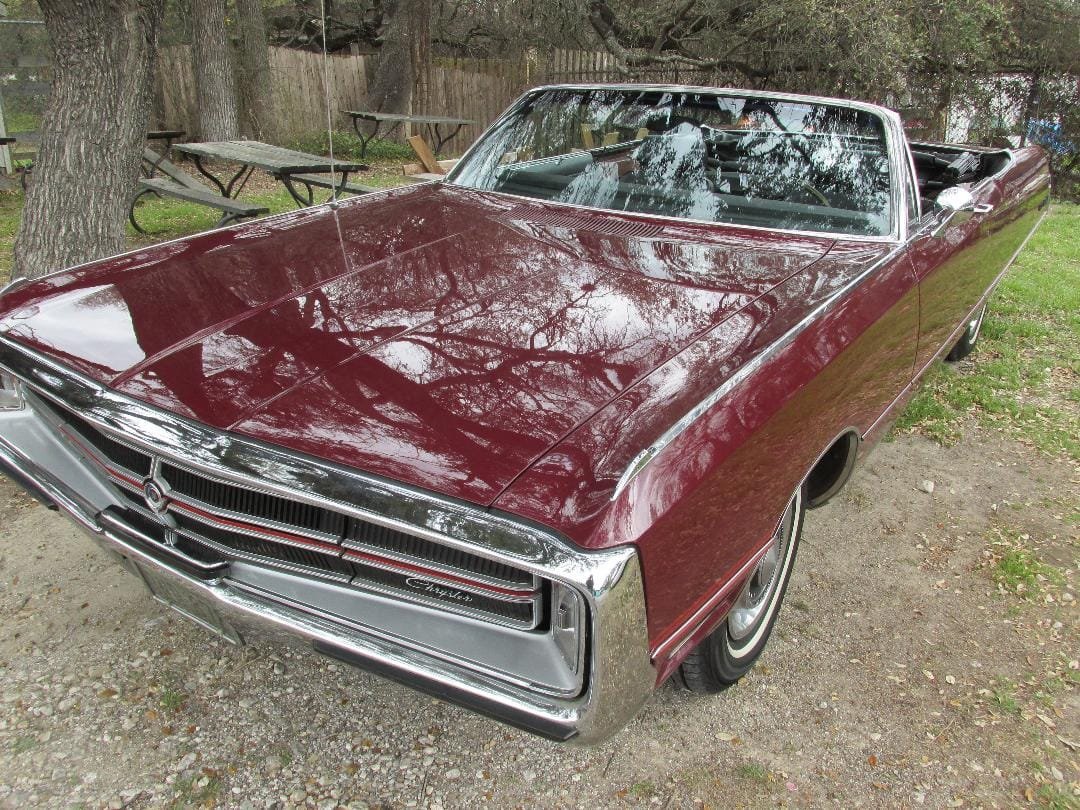
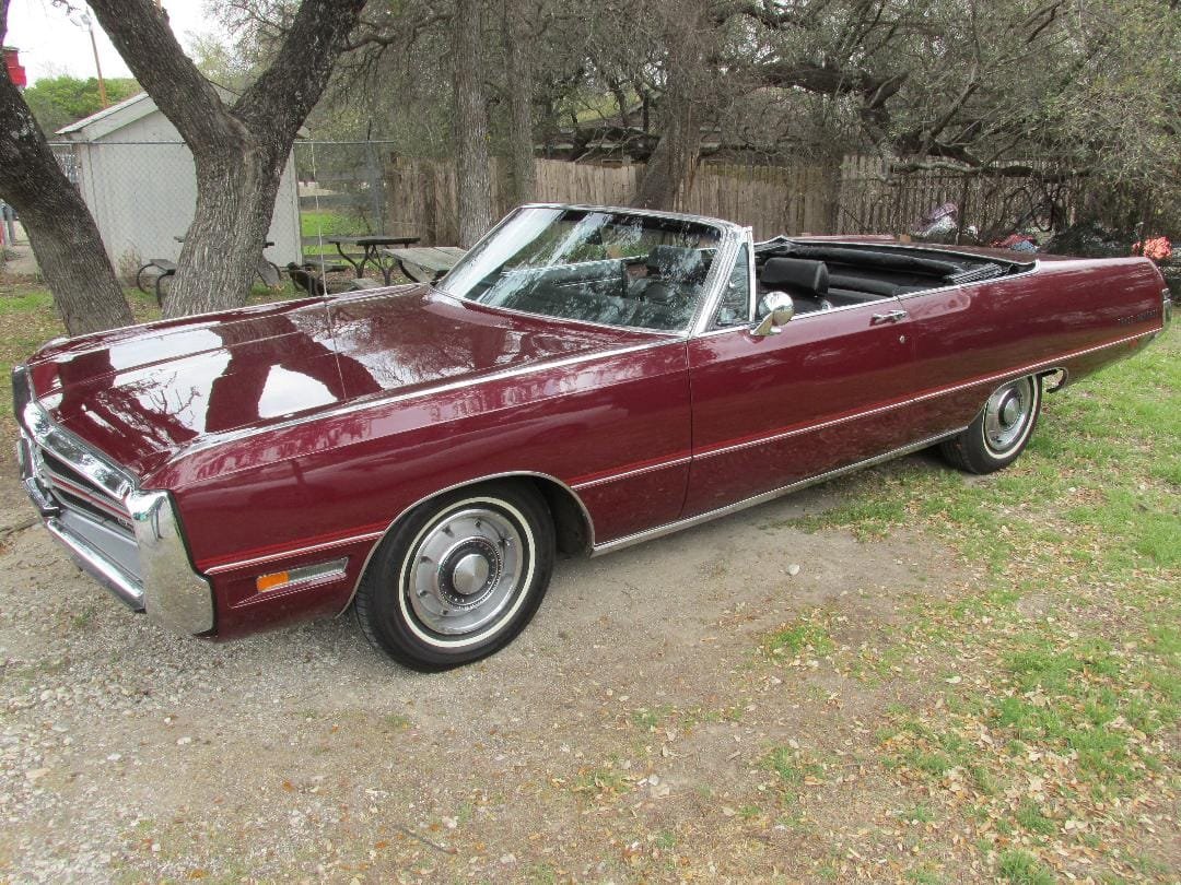
The 1969 Chrysler 300 Convertible featured here was a full size luxury automobile that embodied the style and sophistication of its era. The first Chrysler 300 came out in 1955 and the design of the first Chrysler 300’s were led by noted automotive designer Virgil Exner. The goal for the design team working on the 1955 Chrysler’s was to achieve a complete break from the past.
Virgil Exner and the Forward Look
The story about how Chrysler redesigned their models in the 1950’s is all about Virgil Exner and his Chrysler design team.
By May 1955 Chrysler’s Forward Look was a part of all models with both logos and slogans. While the Forward Look slogan was a creation of a New York and agency, the inspiration was Virgil Exner’s designs. The wedge shaped styling of the Chrysler 300 letter series and updated 1957 models, with their long hoods and short decks, uplifted Chrysler to the forefront of design, with Ford and General Motors scrambling to follow up and using many of Exner’s design traits.
Chrysler Fuselage Styling
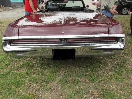
Chrysler redesigned the bodies of its largest cars for the 1969 model year. It’s new Fuselage styling was introduced in August 1968 for the 1969 model year. The main reason for this redesign was to replace the boxy design that Chrysler produced from 1965 until 1968. The new model was a head turner. With its distinctive gun-sight grille (the gun-sight styled grille would be eliminated starting with the 1970 model in favor of variations of the remaining horizontal chrome band) , hidden headlights, long hood, and sleek lines, it certainly was a true head turner that exuded class and power. The car was available in both two-door and four-door versions, with the latter being the more popular choice.
The 1969 Chrysler 300 was a masterclass in automotive design, blending power, elegance, and performance into a package that remains iconic to this day. In September 1969 Car Life magazine released its ‘Best Of’ issue, a title awarded by market segment and vehicle class. In the ‘Prestige Car’ category, CL declared the Chrysler 300 as the best of the class over three other models; a Buick Wildcat, a Mercury Marquis, and an Oldsmobile entry.
1969 Chrysler 300 Specifications
Under the hood is Chrysler’s legendary 440 cubic inch V8 engine with a four barrel carburetor and 350 HP. The 440 was Chrysler’s largest big block engine and first appeared in 1966. The engine was soon available in both full size sedans and coupes as well as in intermediate muscle cars. This big block V-8 engine was built with a cast iron block and heads.
The standard transmission is a three speed manual with an option for a three speed TorqueFlite automatic.
Brakes are four wheel hydraulic drums.
Independent front suspension are coil springs, shock absorbers with upper and lower A-arms. Rear suspension are coil springs, heavy duty shocks and leaf springs.
Dimensions for the 1969 Chrysler 300 includes a 124.0 inch wheelbase, 224.7 inch overall outside length, 79.1 inch width, 55.6 inch height. Curb weight about 4,025 lbs.
The 1969 Chrysler 300 Two Door Convertible is a rare automobile with only an estimated 1933 units produced. This compares to 30,500 Hardtops built for 1969. Total Chrysler 1969 production covering all models were 260,750 vehicles. The Chrysler 300 Convertibles, along with convertibles across the entire Chrysler lineup were discontinued after the 1970 model year where only slightly over 1,000 examples of the 300 convertible models were built. Chrysler’s decision to stop producing convertibles at that time had to do with both the weak economy and new federal safety regulations.
Related Auto Museum Online articles…
Reference materials include…Chrysler 300 “America’s Most Powerful Car” by author Robert Ackerson…..The Chrysler 300 Anthology by Harry W. llaeia…Complete Book of Collectible Cars by the Editors of Consumer Guide.
Many Chrysler classics are highly sought after collectibles. Many collectible Chrysler’s have stood the test of time. Chrysler’s sleek cars of the 1960’s and 1970’s, such as the Chrysler 300 and Dodge Charger, have maintained a large collector and enthusiast following.
The 1969 Chrysler 300 combined powerful engines, classic American style, a bold, muscular design along with a degree of luxury that few of its competitors could match. This powerful Chrysler embodied the spirit of the muscle car era.
Current sale prices for a 1969 Chrysler 300 Convertible in very good to excellent condition and highly original are seen in the $28,000 to $32,000 range.
CarsCover Retro Classic Megashield Car Cover Heavy Duty All Weatherproof Waterproof Automobiles Indoor Outdoor Snow Rain Dust UV Protection Full Auto Vehicle Covers (Fit up to 225 inch Length)
Auto Museum Online searches for various products that we feel the classic car and automobile community in general can benefit from. As an Amazon Affiliate, Auto Museum Online earns a commission from qualifying purchases through my links, at no cost to you.
(Article and photos copyright Auto Museum Online)