Thank you for reading this post, don't forget to subscribe!
Trips Into History traveled the historic and very scenic Los Caminos Antiguos Scenic Byway. Here is a national Scenic Byway that travels through three counties of southern Colorado and through the Sangre de Cristo National Heritage Area.

In North America, certain roads are designated as scenic byways based on their archaeological, cultural, historic, natural, recreational, and overall scenic qualities. America’s Byways are a distinctive collection of American roads, their stories and treasured places.
The name of this scenic byway means “the ancient road” and it is true that this roadway winds itself through an area that was once home to the ancient Indians of the southwest as well as the territory of Nuevo Mexico once ruled by Spain.
Travel on the Los Caminos Antiguos Scenic Byway and you’ll have the opportunity to explore the culture and traditions of some of Colorado’s oldest communities. You’ll view the spectacular San Juan and Sangre de Cristo Mountain ranges as well as the high, fertile San Luis Valley which is today Colorado’s largest agricultural area. Also, along this highway you’ll explore the fascinating Great Sand Dunes National Park, the site of the highest sand dunes in North America.

Some of the Unique Sites Along the Los Caminos Antiguos Scenic Byway
The entire length of the Los Caminos Antiguos Scenic Byway is 129 miles and the travel time for it’s exploration will take perhaps four hours. Travel time will be dependent on how many stops you make along the way. Interpretive markers along the way will direct you to specific sites that tell the region’s history and make the journey so enjoyable.This scenic highway is open during the entire year.
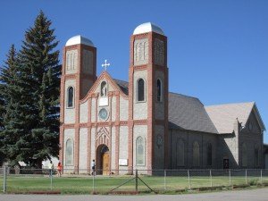
Our Lady of Guadalupe Church
This church was founded in 1856 and it’s parish is the oldest in Colorado. The first church was constructed of logs put together with adobe. In 1863 a larger adobe church was built. Renovations took place through the years but the building was destroyed in 1926 by an electrical fire. The walls and towers were spared but new brick towers and a brick entrance were built in 1948.When you visit the church you’ll notice a niche above the front entrance near the roof line containing the statue of the Virgin of Guadalupe. This is the original statue brought by the first settlers of the area.

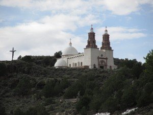
Shrine of the Stations of the Cross
In the town of San Luis Colorado you’ll see a mesa just a few yards west of the scenic byway off of main street. This is the location of the Shrine of the Stations of the Cross. A walkway up the side of the mesa leads past 3/4 size bronze statues by local sculptor Huberto Maestas. The statues depict Christ’s last hours. At the end of the three quarter mile walkway is the Chapel of All Saints which is used by pilgrims for prayer and meditation. On top of the mesa are additional statues of martyrs and saints.From atop the mesa you’ll see the town of San Luis below and the People’s Ditch, the oldest communal irrigation waterway in Colorado.
The mesa is named La Mesa de la Piedad y de la Misericordia (the Hill of Piety and Mercy) .Look for the interpretive signs at the trail head on the left side of the highway as you enter the town from the south.

Historic Fort Garland
North of San Luis is historic Fort Garland, once an important frontier fort that was established in 1858 to protect settlers of the San Luis Valley and at one time commanded by Kit Carson and occupied by the Buffalo Soldiers after the Civil War.
Today, Fort Garland exhibits several restored original buildings and offers visitors several separate museums within the structures. You’ll see authentic frontier firearms, many artifacts from the 1800’s and recreations of original interiors such as the infantry and cavalry barracks and the commander’s quarters. All of the structures were built around a parade ground with it’s historic flagpole in the center.
Looking north from Fort Garland you’ll see the towering Blanca Peak rising some 14,345 feet above sea level. Blanca Peak is the fourth highest peak in Colorado.
On our Western Trips site you’ll enjoy our photo article of Fort Garland found on the link below…

Alamosa Colorado
Alamosa went from a tent city to a full fledged town almost overnight when tracks of the Denver and Rio Grande Railroad reached the settlement.Today, a great many of the buildings in Alamosa are on both the Colorado State Register of Historic Properties and the National Register of Historic Places.
One of the best ways to explore Alamosa is with a downtown walking tour. Maps are available at the Colorado Welcome Center located at the D & RG train depot. Add to your trip a visit to the San Luis Valley Museum. The museum exhibits artifacts, photos and collectibles that portray early farm life in the valley. Also exhibited are Indian and Hispanic artifacts and artifacts and photos of the early railroad.
The link below will take you to our photo article of Alamosa Colorado on our Western Trips site…

The Great San Dunes
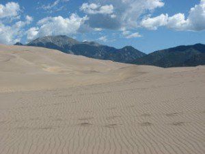
The Great Sand Dunes National Monument was created in the 1930’s during the Great Depression. By the year 2004 the park also included a preserve. The preserve was then joined with the Great Sand Dunes Monument and was then the combined area was named a full-fledged National Park in September 2004. It contains about 39 square miles of massive sand dunes, some 750 feet high. The Great Sand Dunes National Park also includes alpine lakes and tundra, six mountain peaks in the Sangre de Cristo Mountain Range.
The Great San Dunes National Park is located about 29 miles northwest of Fort Garland and about 34 miles east/northeast of Alamosa.
Below is a link to our Western Trips photo article on the Great Sand Dunes National Park…

There’s Plenty to See on the Los Cominos Antiguos Scenic Byway
The above sites along the Los Caminos Antiguos Scenic Byway are just a few of the sites you’ll see during your road trip. For more information about the route and additional sites along the way see website www.coloradodot.info/travel/scenic-byways/south-central/los-caminos Here you will find much more detailed information as well as a map of the route.
Again, this area of southern Colorado is one of the most scenic and historic in the entire country. If your future travel plans call for a visit to this part of the country you may just want to add this historic scenic byway to your trip planner.
(Article and photos copyright 2013 Trips Into History)
