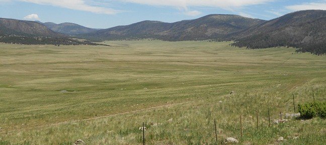
Take a scenic drive west of Los Alamos New Mexico on NM Rte 4 and you’ll come to Valles Caldera National Preserve. This 89,000 acre expanse is sitting inside a collapsed crater. Interestingly enough, this area was the well known Baca Ranch until the year 2000.
Thank you for reading this post, don't forget to subscribe!The Creation of the Crater

A “caldera” is a cauldron-like volcanic feature that’s usually formed by the collapse of land following a volcanic eruption. This is a bit different than a crater. A crater is sometimes caused by celestial bodies colliding with the earth. At the same time there are craters caused by volcanic activity. The difference is that a crater is a bowl shaped depression. A crater can be made by an impacting meteor, an underground land collapse, or it could be found at the top of a volcano. With a caldera there was an eruption after which the magma chamber collapsed and then was filled in. Another explanation of the difference between the two is that a crater is a steep walled depression located at the top of a volcano.
The Valles Caldera which is sometimes referred to as the Jemez Caldera, is twelve miles wide. It is quite unique, being only one of six known land based supervolcanoes. Native tribes roamed the caldera over 11,000 years ago. The tribes hunted on the caldera land and spear points have been discovered dating back to that time. The tribes in this area collected “obsidian” which is a volcanic glass used back then for spear points. The obsidian was in demand and trading went on for it between the tribes of the southwest.
Special Photographic Tours Scheduled for 2013
Two three day photographic excursions of Valles Caldera crater will be offered during 2013.
Visitors for these events will be chosen by lottery. Camping will be allowed at a designated location. Officials say the lottery closes April 24 for the first photography event, which is scheduled for May 24-26. The second events is scheduled for Sept. 20-22, and the lottery closes on Aug. 21. Anyone can apply by calling the preserve at 1-866-382-5537.

The U.S. Congress passed the Valles Caldera Preservation Act in the year 2000. The act states that Congress established the Valles Caldera Preserve in order “to protect and preserve the scientific, scenic, geologic, watershed, fish, wildlife, historic, cultural, and recreational values of the preserve, and to provide for multiple use and sustained yield of renewable resources within the preserve. This Congressional act authorized the federal purchase of Baca Location No.1 and established the Valles Caldera Trust as the manager of the Valles Caldera National Preserve. Science projects are a big part of what is currently happening at the preserve. There is a project in it’s third year to create a new geologic map of the preserve. The new map is intended to replace the 1970 USGS map of the same area and provide greater details to help geologists better understand the formation of the caldera and the Jemez Mountains region in general. A core sample taken in 2004 will provide details on the lake bed sedimentary history of the Valle Grande.
Driving Scenic New Mexico Route 4

When you take a western road trip into the Jemez Mountains on NM Rte 4 west of Los Alamos, there are many fascinating sites to see in the vicinity of the Valles Caldera. This includes Battleship Rock directly on Route 4.
Battleship Rock received it’s name because the rock high colorful rock resembles the bow of a battleship. There’s also an excellent hiking trail head at Battleship Rock which will take you to Jemez Warm Springs and Jemez Falls. The trail is rated moderate and takes about three hours round trip. Drive a bit further on NM Rte 4 and you’ll arrive a beautiful Jemez Springs which is home to the Jemez State Monument. The Jemez State Monument features the ruins of a pueblo Indian village and mission dating back to the 1620’s.
Two additional sites we’ve written articles on are Jemez Springs in the Jemez Mountains and Bandelier National Monument.
(Photos are from author’s private collection)

