There’s one fun and historic event that occurs each year sponsored by the National Pony Express Association. It’s a Re-riding of the 1,966 mile Pony Express Trail and it takes place each June. This event offers a fun and close glimpse into the era of the famed Pony Express.
Thank you for reading this post, don't forget to subscribe!
The NPEA’s main aim is to keep the spirit and memory of this National Historic Trail alive. Headquartered in Pollock Pines California, right on the old trail itself, the NPEA works to preserve the trail and what better way to do that than to put together a reenactment of the Pony Express ride.
Prior to the NPEA forming, there were three re-rides of the trail. The first Pony Express Re-Ride was held in 1935 which commemorated the 75th anniversary of the trail. There was another re-ride held in 1958 sponsored by the Western States Trail Ride. This famous re-ride actually carried U.S. Mail. Then again in 1960, as a 100 year commemoration, there was a re-ride put together by the Western Pony Express Trails Association along with the Central Overland Pony Express Trails Association.
The next ride after the ones mentioned above didn’t occur until the NPEA was formed in 1977.
The Old Trail
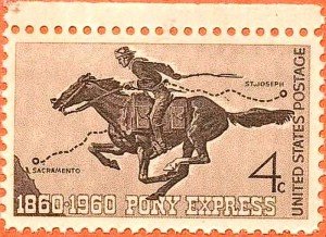
The Pony Express National Historic Trail runs from Missouri to California. The very fact that riders accomplished this arduous and dangerous task of getting mail to Sacramento California from St. Joseph Missouri in about ten days overshadowed the fact that the Pony Express only existed for eighteen months. Only ten days to deliver a letter to California was fascinating to the public at that time considering the alternative routes would have been by steamer either around Cape Horn or over to and across the Isthmus of Panama. In both cases it was months, not days.
The Pony Express operated in the west during the American Civil War. This was several years before the Indian Wars on the Plains began. This was years before Red Cloud’s War and the Fetterman Massacre in Wyoming, sixteen years before Custer’s defeat at the Little Bighorn and decades before the Indian Wars in the west officially came to an end.
It was a time when traveling on horseback day and night over primitive routes through Indian country could be quite dangerous in the least.
Necessities included a fast horse, a wiry rider and the ability to find your way in daylight and darkness. You may have seen the old advertisements for Pony Express riders which suggested that orphans were preferable. It was both dangerous and adventurous.
Today’s Pony Express Trail
The proposed route for the Pony Express was very simple. It headed west out of St. Joseph Missouri, up the Platte and Sweetwater rivers, through South Pass Wyoming and the Rockies to Salt Lake City. The route then ran out across the Utah and Nevada deserts, up and over the Sierra Nevada and into California at the south end of lake Tahoe and then down the western side of the Sierra Nevada.
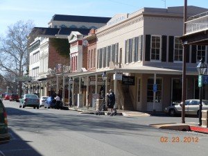
Segments of today’s Pony Express Trail are both publicly and privately owned. The National Park Service depends on many organizations and private land owners to keep this historic trail alive. This involves communication with state governments and municipalities. The Pony Express National Historic Trail follows the 1,900-mile route taken by those daring riders through the states of Missouri, Kansas, Nebraska, Colorado, Wyoming, Utah, Nevada, and California.
Just as with other notable old western trails, much of the original trail has been worn away by weather and modernization. Some of the best remaining segments are to be found in Utah and California. Eventually, the Pony Express National Historic Camp Trail is planned to run past 120 historic sites related to the famous yet short lived mail operation, including what remains of 50 stations along the route.
Exploring the Pony Express Trail
Driving directions and maps are available to provide modern travelers with directions along highways that approximate the historic route taken by the Pony riders during the eighteen months that it operated from 1860-1861. The link Pony Express National Trails has a map where you can pinpoint what parts of the trail you intend to visit. In California for an example, the old Pony Express Route generally follows U.S. Hwy 50 up the western slope of the Sierra Nevada. U.S. Hwy 50 is also the primary route to take through Nevada toward Utah. In Utah, the route travels northeast past Salt Lake City and into Wyoming.
Two additional articles you’ll find interesting include a Visit to Old Town Sacramento California and Traveling on the Old Butterfield Stage Line.
The Utah Segment
The Pony Express Trail National Back Country Byway in Utah begins near Fairfield and ends at Ibapah, Utah.
Add Camp Floyd / Stagecoach Inn State Park on state highway 73, 5 miles south of Cedar Fort to your trip planner. Then add the Pony Express National Back Country Byway Visitor Information Site. The location is 1.8 miles west of the Fausts Junction along the north side of the Pony Express Trail. The station there was named after station keeper “Doc” Fausts. The station was a two-story stone structure located some distance from the present historical marker which was erected in 1939. The entire Back Country Byway is 133 miles long. Most of the route is range land and managed by the Bureau of Land Management.
Visiting historic segments of the Pony Express Trail makes an excellent addition to your western road trip planner. The map provided by the National Park Service is a good place to start in planning your upcoming road trip. Attending a segment of the annual NPEA Re-Ride is also a great way for the entire family to learn about the days of the Pony Express. For more information, visit the NPEA site at www.xphomestation.com
(Photos and images from the public domain)
